Ministerial Infrastructure Designation
On 3 November 2025, the Minister for State Development, Infrastructure and Planning initiated consultation by writing to the local government and impacted landholders to invite submissions on the Ministerial Infrastructure Designation (MID) Assessment Report.
As part of the process, Powerlink commenced its 20 business day public consultation period from 17 November 2025 to 5pm on Friday 12 December 2025.
Consultation completed during this time included letters and emails to impacted landholders, Traditional Owner groups and key stakeholders as well as the distribution of a project newsletter to residents and businesses along the MID corridor.
A series of community information drop-in sessions were also held at several locations along the MID corridor to provide landholders, local residents, the wider community and other stakeholders with an opportunity to meet our project team and discuss the MID Assessment Report.
Hard copies of the MID Assessment Report were made available at the following locations:
- Earlville Library, Shop 128 Earlville Shopping Town
- Cairns City Library
- Cairns Regional Council offices
- Office of the Member for Barron, Ms Bree James
- Office of the Member for Mulgrave, Mr Terry James
- Office of the Member for Cairns, Mr Michael Healy
The project is currently awaiting a decision regarding the MID request.
The MID assessment process includes a comprehensive assessment of land use planning matters which considers advice from other state agencies, local governments and technical experts.
This process is managed by DSDIP with input from other government agencies.
The assessment of a MID focuses on the proposed land use, and its associated impacts including aspects such as traffic, car parking, stormwater, noise, ecology, amenity and built form.
A decision on the MID will be made after considering the assessment and submissions received during consultation. Relevant issues raised in submissions will be provided to Powerlink for consideration.
Project Planning and approvals
Background
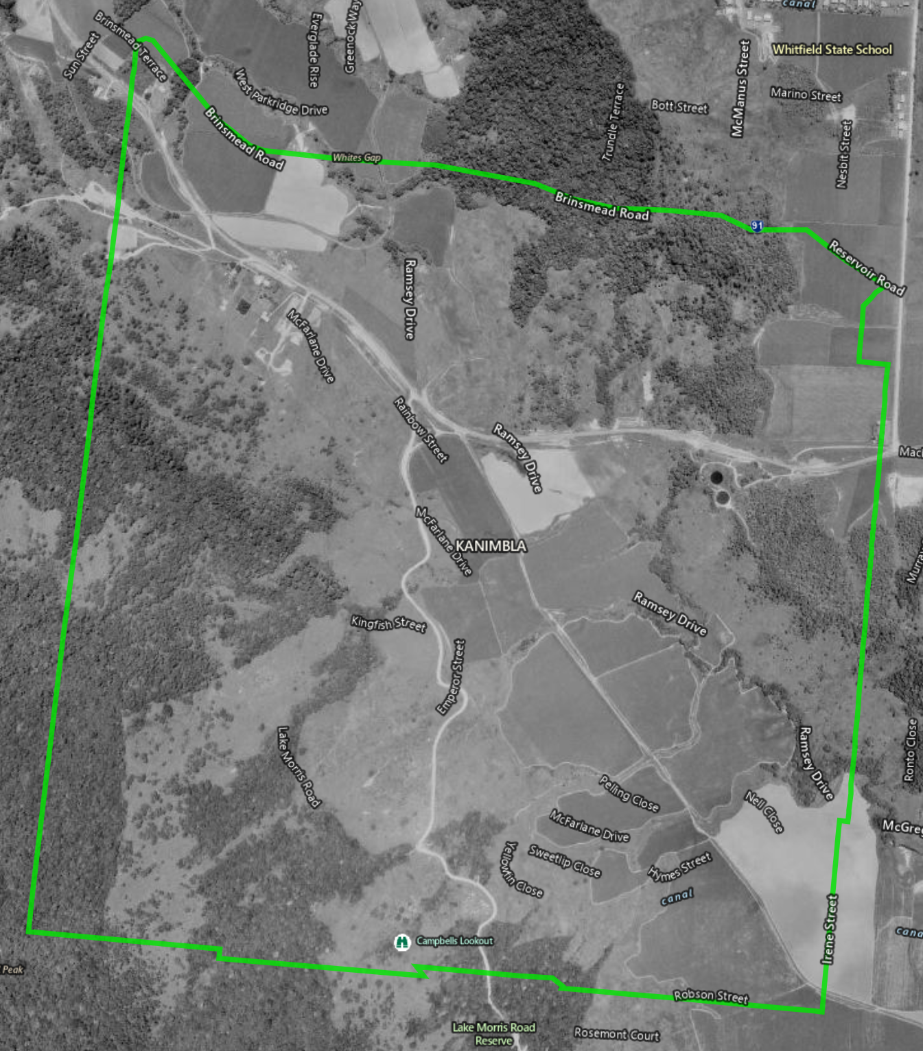
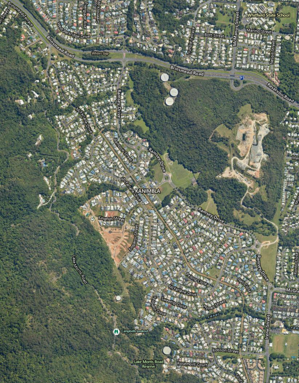
The Kamerunga to Woree 132 kilovolt (kV) transmission line provides the critical service of connecting the Barron Gorge Hydroelectric Power Station to the transmission network and supplying power to northern Cairns.
This line has been in operation since the 1960s, and a replacement line will need to be constructed.
Powerlink standards require an easement for an overhead 132kV transmission line to be around 30 to 40 metres wide. When the Kamerunga to Woree line was built, industry standards at the time required the easement to be 20m wide. As standards evolve over time, we now require a wider easement to enable the continued safe, secure and reliable operation of the transmission line.To ensure continuous electricity supply to the area, we must maintain the existing line while constructing a new replacement transmission line. Where possible, we have positioned the recommended corridor for the new infrastructure adjacent to the existing line.
There has been significant residential development adjacent to the line between Redlynch to Woree meaning that we are unable to widen the existing easement through this area. Therefore, the decision has been made to underground this component of the line along a new corridor.
Replacement infrastructure
New substation in Barron
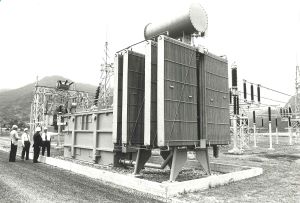
The existing Kamerunga Substation, located in Caravonica, is nearing the end of its technical service life.
The recommended substation replacement site is a Powerlink-owned parcel of land off Cairns West Arterial Road, approximately 600m from the existing substation location. The parcel of land was purchased in 2021 to account for anticipated future transmission network requirements.
New transmission line
Kamerunga to Redlynch – overhead line
The existing Kamerunga Substation connects the Barron Gorge to Cairns transmission line from the Barron Gorge Hydroelectric Power Station to the existing Kamerunga to Woree line.
The proposed overhead transmission corridor will include a connection to the Barron Gorge to Cairns line from a point at the existing Kamerunga Substation site to the new substation in Barron. The corridor will then proceed to the Redlynch masterplan area.
The new corridor is directly adjacent to and east of the existing line and is mainly located on primary industry and industrial land, as well as State and Local Government owned land.
Redlynch to Woree – underground cable
Significant residential development since the overhead transmission line was first established has meant the construction of a new overhead line from Redlynch to the Woree Substation is not feasible. Alternative overhead line routes would also pose significant impacts to residential areas.
As a result, Powerlink is proposing to transition from an overhead transmission line via a transition point at Redlynch to a 10.4km underground cable to the Woree Substation.
The underground cable will follow a different corridor to the existing overhead line and will be largely located in Council and State-owned roads. No residential land or easements on private property will be required to construct the underground cable.
From Redlynch, the proposed underground corridor will run under Freshwater Creek and through Goomboora Park before continuing through roads, footpaths and verges to the Woree Substation.
State Government approval
Powerlink has submitted a request for a Ministerial Infrastructure Designation (MID) to provide planning approvals for delivery of the new substation and transmission line as a single program of works.
A MID can be used to deliver certain types of community-supporting infrastructure such as hospitals, schools, police/ambulance/fire stations, sporting facilities, power lines, water supply infrastructure and sewerage treatment plants.
The process of identifying the transmission corridor requires consideration of multiple social, economic and environmental factors including:
- Tenue and zoning
- Future land use
- Environment
- Heritage values
- Economic
- Traffic and community impacts
- Existing infrastructure
- Hydrology
- Network reliability
Community feedback
July 2025: Release of the Final Corridor and Site Selection Report
In July 2025, Powerlink released the Final Corridor and Site Selection Report which outlines the work undertaken to identify the final corridor for both the replacement overhead transmission line and underground cable, and a final site for the new substation. Where appropriate, feedback during the preliminary engagement phase was used to inform the final corridor and site selection that was submitted as part of the MID approval process.
The main areas of feedback received included:
- flooding impacts in relation to the new substation location
- increased cyclone resilience with undergrounding a section of the transmission line
- construction timings and impacts
- future use of the easement along the existing Redlynch to Woree section
- impact to trees along the underground cable corridor.
September – October 2024: Preliminary engagement
In September Powerlink distributed more than 2000 project introduction newsletters to community members along the proposed corridor as well as to landholders along our existing easement between Kamerunga to Woree.
We ran several community information drop-in sessions in October 2024, in Kamerunga, Redlynch, Earlville and Brinsmead to seek feedback from landholders, Traditional Owner groups, the community and other key stakeholders on the project’s Draft Corridor and Site Selection Report
Next steps
Geotechnical investigations
Geotechnical investigations were originally planned for Q3/Q4 2025, however it is now expected they will be delivered in Q2 2026. This revised timeframe will support the delivery of any additional planning and design work required prior to construction which is scheduled to commence in 2027.
Targeted engagement with nearby residents and community members along the planned works areas will be carried out before on-ground activities commence.
Community engagement
Powerlink will continue to engage with landholders, Traditional Owner groups, the wider community and other stakeholders during the planning and delivery of the project through:
- letterbox drops to properties in the project area
- project newsletters
- door-knocking impacted residents
- website updates
- social media posts
Key community engagement milestones during the planning and approvals process are:
- prior to and during geotechnical investigations
- MID statutory engagement*
- invitation for contractors to tender for project construction delivery
- Decision on the MID request*
* Timings subject to change


